|
|
| Mesoscale Discussion 392 | |
| < Previous MD | |

|
|
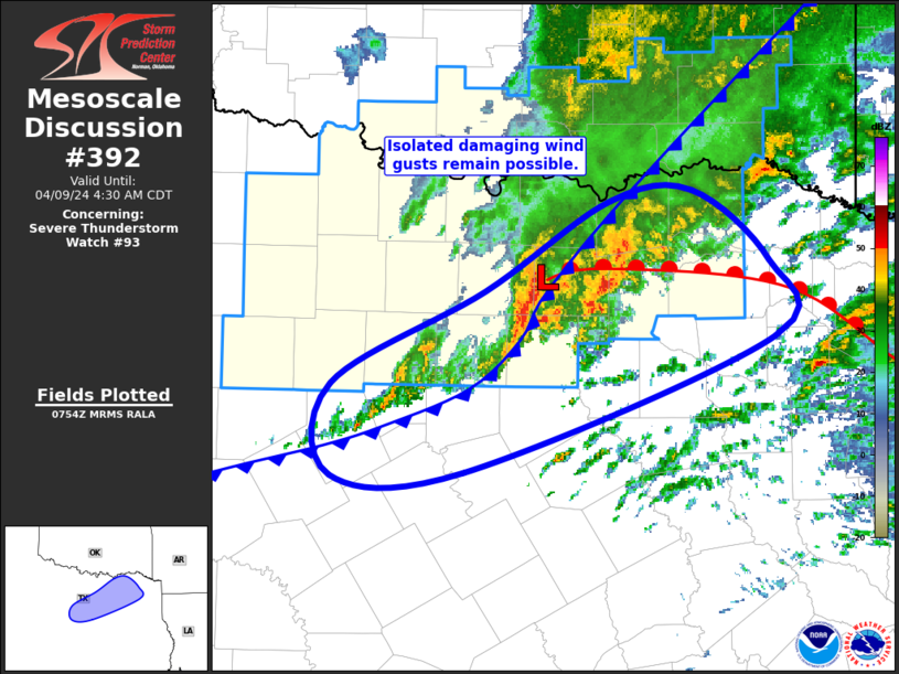
Mesoscale Discussion 0392 NWS Storm Prediction Center Norman OK 0257 AM CDT Tue Apr 09 2024 Areas affected...North-Central into Northeast TX Concerning...Severe Thunderstorm Watch 93... Valid 090757Z - 090930Z The severe weather threat for Severe Thunderstorm Watch 93 continues. SUMMARY...Isolated damaging gusts will remain possible for the next few hours from north-central Texas into northeast Texas. DISCUSSION...Recent surface analysis places a meso-low coincident with the ongoing thunderstorm over northeast portions of the Metroplex. An outflow-augmented cold front extends southwestward from this low into southwest TX. A warm front also extends eastward from this low into northeast TX. Airmass to the east of the ongoing thunderstorm is characterized by low-level stability beneath steep mid-level lapse rates and moderate deep-layer vertical shear. This environment supports the persistence of the ongoing storms as they continue eastward, likely trending more elevated with time. Even so, occasionally strong to severe downdrafts could still reach the surface over the next hour or two, particularly as this storm interacts with the warm front (as evidenced by a recent gust of 53 kt at KDFW). Farther south and west, the airmass is not as hostile to surface-based storms and additional development along the southeastward-progressing front/outflow is possible. However, the notably dry mid-levels will likely act as a deterrent for sustained updrafts, limiting the likelihood for mature updrafts and keeping the overall severe potential low. ..Mosier.. 04/09/2024 ...Please see www.spc.noaa.gov for graphic product... ATTN...WFO...SHV...FWD... LAT...LON 33129718 33689628 33749568 33329513 32849509 32019733 32009830 32559830 33129718 |
|
|
Top/All Mesoscale Discussions/Forecast Products/Home |
|


