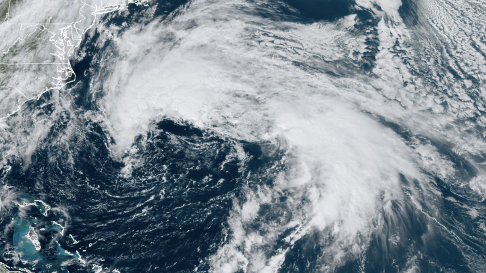
Tropical Storm Philippe was declared a post-tropical cyclone by the National Hurricane Center, or NHC, at 11 a.m. EDT Friday, putting an end to almost two weeks of NHC advisories on the system. Though Philippe will still bring heavy rains and strong winds as it heads north toward Atlantic Canada and New England this weekend, the system is merging with broader midlatitude weather features and has taken on the look of an extra-tropical mid-latitude storm, including a striking comma-shaped cloud pattern on satellite.
Philippe’s top sustained winds at midday Friday were 50 mph. Those winds could actually increase a bit between now and early Sunday. By that point, Philippe will be coming ashore as a post-tropical cyclone somewhere near western New Brunswick or eastern Maine — not far from where former Category 5 Hurricane Lee arrived as a post-tropical system on September 17 after a similar northward dash. Widespread rains of one to two inches will fall this weekend from eastern New York into New Brunswick; some areas could see two to four inches, which might trigger some localized flash flooding.
Like many other Atlantic systems during this busy year, Philippe racked up day after day as a named system well offshore without ever becoming too intense or causing too much havoc. Philippe was a tropical storm for just shy of 13 days, the longest continuous life span as a tropical cyclone for any of the Atlantic’s named storms of 2023. Despite its longevity, Philippe was never a well-organized or intense storm — though it was devilishly difficult to forecast, thanks in part to interactions with nearby Tropical Storm Rina.
Catching a break in the Atlantic
Philippe’s demise puts to an end a remarkable stretch of more than six weeks — from August 23 to October 6 — with at least one named storm prowling the Atlantic. During much of that period, two or more named storms were being tracked. Fortunately, many of these systems stayed east of the Caribbean and North America. The three U.S. landfalls of the 2023 Atlantic season thus far all occurred within this hectic stretch:
- Tropical Storm Harold (50 mph, South Texas, August 22)
- Hurricane Idalia (125 mph, Florida Big Bend, August 30)
- Tropical Storm Ophelia (70 mph, North Carolina, September 23)
The most destructive by far was Idalia, which took at least 10 lives and caused at least $2 billion in insured property damage; total damages are typically twice the insured level.
By the time this weekend is out, Atlantic Canada will also have had three “quasi–named storms” making landfall in 2023. Prior to post-tropical cyclones Lee and Philippe, a subtropical storm struck Nova Scotia with top winds of 55 mph on January 17. This system was belatedly recognized by the National Hurricane Center as a subtropical storm; had it been tracked in real time, it would have been the year’s first named storm.

One more Cabo Verde system to watch
The Cabo Verde season, in which tropical waves stream off Africa into the tropical Atlantic, is rapidly drawing to an end, but there was one more disturbance coming off Africa on Friday that could develop over the next few days. In its Tropical Weather Outlook issued at 2 p.m. EDT Friday, the National Hurricane Center gave this system only a 10% chance of development into at least a tropical depression over the next two days, but a 50% chance over the next seven days as it moves into the tropical Atlantic. Long-range forecast models strongly suggest this system would recurve into the open central Atlantic, should it develop. The next name on the Atlantic list is Sean.
Tropical Storm Lidia nears hurricane strength
At 11 a.m. EDT Wednesday, Tropical Storm Lidia was located in the Pacific waters about 450 miles south of Cabo San Lucas Mexico, drifting west-northwest at 5 mph with top sustained winds up to 70 mph. Lidia boasted a well-defined core of intense convection (showers and thunderstorms) on Friday.
Weak steering currents will keep Lidia drifting generally westward until early next week, when westerly upper winds dipping into the area from higher latitudes will pull Lidia more rapidly northeastward toward the west coast of Mexico. Lidia will likely reach Category 1 hurricane strength by late Friday and approach Mexico by midweek. Although dry air is likely to be injected into the storm as it approaches Mexico, Lidia will be passing over very warm sea surface temperatures of around 29 degrees Celsius (84 degrees Fahrenheit) — even warmer just off the Mexican coast — and currently strong wind shear may be abating by that point. Multiple runs of the new HAFS intensity model have indicated that Lidia could be an intensifying hurricane as it approaches Mexico, so Lidia’s evolution will need to be watched closely.
Before any arrival of Lidia, Mexico’s Pacific coast may be affected by a disturbance called Invest 99E that’s brewing several hundred miles southeast of Acapulco. Forecast models suggest this system could develop over the weekend and perhaps reach the coast as an intensifying tropical storm by late Monday. In their 2 p.m. EDT Friday Tropical Weather Outlook, NHC gave this future disturbance two-day and seven-day odds of development of 10% and 80%, respectively. The next name on the Eastern Pacific list is Max.
Our next tropical post will be on Monday, October 9; we’ll be adding inline updates to this post as needed.
Jeff Masters contributed to this post. Website visitors can comment on “Eye on the Storm” posts (see comments policy below). Sign up to receive notices of new postings here.
Source link


