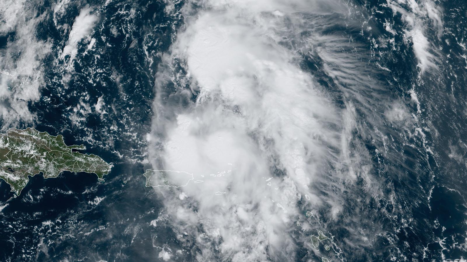
A Tropical Storm Watch is up for Bermuda as a disorganized Tropical Storm Philippe pulls away from the Leeward Islands. Philippe brought flooding rains to portions of the Leeward Islands, Virgin Islands, and Puerto Rico over the past few days, but these rains will taper off by Wednesday night.
At 11 a.m. EDT Wednesday, Philippe was located about 770 miles south of Bermuda and was headed north-northwest at 7 mph. Phillipe remained disorganized and had top sustained winds of 45 mph and a central pressure of 1004 mb. Puerto Rico radar showed that Philippe was bringing a few heavy rain showers to northeastern Puerto Rico and the U.S. and British Virgin Islands. Satellite images continued to show an unhealthy tropical storm, with an ill-defined low-level center and heavy thunderstorms scattered around the center of the storm.
Forecast for Philippe
Philippe is expected to move north-northwest to north for the remainder of the week, bringing the storm near Bermuda on Friday morning. Wind shear is predicted to prevent significant strengthening, and the National Hurricane Center forecast calls for Philippe to peak with 60 mph winds on Saturday when it will be transitioning to a powerful post-tropical storm and approaching Atlantic Canada. Remarkably, Philippe is expected to make landfall very close to where post-tropical cyclone Lee did in September – in Atlantic Canada near the Maine border. At landfall, Philippe is likely to have transitioned to a post-tropical storm with top winds of 55-65 mph. The impacts of Philippe in Atlantic Canada and the U.S. will likely be less than those of Lee, which killed two people and caused damages in the tens of millions, according to insurance broker Aon.
Tropical Storm Lidia may threaten Mexico next week; Max likely to form by early next week
At 11 a.m. EDT Wednesday, Tropical Storm Lidia was located in the Pacific waters about 625 miles south of the tip of Mexico’s Baja Peninsula, headed north-northwest at 8 mph with winds of 50 mph and a central pressure of 1001 mb. Lidia is expected to gradually intensify and be near hurricane strength by Saturday as it heads northwest and then west, away from the coast of Mexico. Early next week, Lidia may experience a significant shift in steering currents that may take it toward Mexico. Only a minority of GFS and European model ensemble members have such a landfall scenario, however, so it’s too early to make any confident predictions.
An area of disturbed weather in the waters a few hundred miles south of the Guatemala border is likely to develop into a tropical depression this weekend or early next week, according to recent runs of the GFS and European models and many of their ensemble members. This system is likely to bring heavy rains capable of causing life-threatening flooding to portions of the coast of southwestern Mexico next week. In their 8 a.m. EDT Wednesday Tropical Weather Outlook, NHC gave this future disturbance two-day and seven-day odds of development of 10% and 80%, respectively. The next name on the eastern Pacific list of storms is Max.
Typhoon Koinu brings an extraordinary wind gust of 213 mph to Taiwan
Typhoon Koinu is pounding Taiwan as it approaches a landfall on the southern tip of the island, expected to occur near 6 p.m. EDT Wednesday, according to the Joint Typhoon Warning Center. Koinu passed over the island of Lanyu – about 40 miles east of the southern tip of Taiwan – on Wednesday morning, bringing sustained 10-minute average winds of 106 mph, gusting to an extraordinary 213 mph (see Tweet below). The Lanyu gust was apparently recorded at a height of 324 meters or 1063 feet. If confirmed, this would be one of the highest wind gusts ever measured at a surface weather station in world history. The only stronger ones were a 253-mph gust at Barrow Island, Australia during Hurricane Olivia in 1996, and a 231-mph gust at Mt. Washington, New Hampshire on April 12, 1934. Chris Burt has an 2020 excellent post detailing the top 10 wind gusts in world history.
At 8 a.m. EDT Wednesday, Koinu’s top sustained winds were 130 mph, making it a low-end category 4 storm. The Joint Typhoon Warning Center is predicting Koinu will weaken slightly and be a category 3 storm with 120 mph winds at landfall. Koinu’s angle of approach will put Taiwan on the stronger right-hand side of the storm, heightening the risk of torrential rains and flooding across upslope regions of eastern Taiwan. Rainfall amounts on favored slopes could exceed 20 inches.
Bob Henson contributed to this post. Website visitors can comment on “Eye on the Storm” posts (see comments policy below). Sign up to receive notices of new postings here.
Source link


