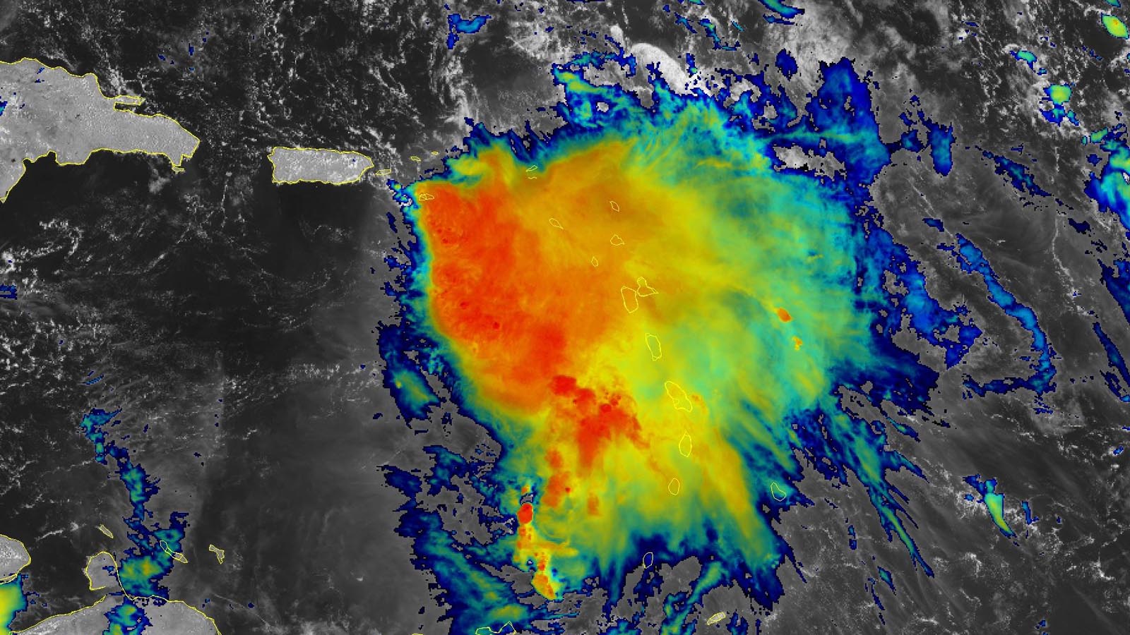
Tropical Storm Philippe brought torrential rains on portions of the Leeward Islands overnight, causing flash flooding on Barbuda, Antigua, and Guadeloupe. On Antigua, Philippe dumped 156 mm (6.14 inches) of rain in the six hours ending at 2 a.m. EDT Tuesday. Peak wind gusts Tuesday morning included 47 mph on Antigua, 52 mph on Montserrat, and 37 mph on Guadeloupe. According to AP, Philippe knocked out power to 2,500 customers on Guadeloupe and blocked roads.
At 11 a.m. EDT Tuesday, the center of Philippe was located about 70 miles northwest of Anguilla in the northern Leeward Islands, headed northwest at 10 mph. The Hurricane Hunters had found that Philippe had weakened, and now had top sustained winds of 45 mph and a central pressure of 1004 mb. Martinique radar showed that Philippe was bringing bands of heavy rains to a large portion of the Lesser Antilles. Satellite images showed an unhealthy tropical storm, with an ill-defined low-level center and all of Philippe’s heavy thunderstorms confined to the southeast side of the storm.
Forecast for Philippe
The models have come into much better agreement on the forecast for Philippe. The storm is expected to move north-northwest to north through Wednesday, dragging the storm’s heaviest rains through the northern Leeward Islands. The main threat to the islands will be heavy rains, with storm total amounts of 4-8 inches predicted for much of the Leeward Islands and British Virgin Islands, with 1-4 inches on surrounding islands. Note that some of these heavy rains will fall outside the official Tropical Storm Warning area (which was limited to Anguila as of 11 a.m. EDT Tuesday); such warnings are typically focused on areas where tropical-storm-force winds are expected.
Beginning on Friday, when Philippe will be nearing Bermuda, wind shear is predicted to relax, allowing for some modest strengthening. The National Hurricane Center, or NHC, forecast calls for Philippe to peak with 65 mph winds on Saturday, when it will be approaching Atlantic Canada. An eventual landfall in Atlantic Canada on Sunday is predicted by most of the models, though Maine should be alert for any potential westward deviation in Philippe’s forecast track. On Sunday, Philippe is likely to have transitioned to an extratropical storm with top winds of 55-65 mph.

A tough storm to forecast
As documented by Michael Lowry in his substack feed, “Philippe has been a persistent thorn in the side of hurricane forecasters, challenging other difficult forecasts like Wanda in 2021 and Joaquin in 2015 (though not as severe as Cristobal in 2014)”. The average 5-day NHC track forecast error in recent years has been approximately 190 miles, but has been nearly 450 miles for Philippe. Much of this forecast difficulty came from Philippe’s interaction with Tropical Storm Rina.
Tropical Storm Lidia forms in the eastern Pacific; Max likely to form by this weekend
As is often the case, when the Atlantic tropical storm activity gets quiet, the eastern Pacific heats up. Tropical Storm Lidia formed in the waters well south of the Mexican coast on Tuesday morning, but is not a landfall threat for Mexico this week. Lidia is expected to gradually intensify into a hurricane by Friday as it heads northwest and then west, away from the coast of Mexico.
Long-range forecast models are predicting development of another system in the eastern Pacific late this week or this weekend in the waters a few hundred miles south of the region near the Mexico-Guatemala border. This system is likely to be a heavy rain threat for the coast of southwestern Mexico. In their 8 a.m. EDT Tuesday Tropical Weather Outlook, NHC gave this future disturbance two-day and seven-day odds of development of 0% and 70%, respectively. The next name on the eastern Pacific list of storms is Max.
It’s been a near-average hurricane season in the eastern Pacific so far in 2023, with 12 named storms, seven hurricanes, five major hurricanes, and an accumulated cyclone energy (ACE) index of 122.8. The 1991-2020 averages for this point in the season are 14.1 named storms, 7.6 hurricanes, four major hurricanes, and an ACE index of 115.
Typhoon Koinu takes aim at Taiwan
After peaking as a Category 3 storm with 125 mph winds on Tuesday, Typhoon Koinu has been gradually weakening as it heads for Taiwan. According to the Joint Typhoon Warning Center, at 8 a.m. EDT Tuesday, Koinu’s top sustained winds were 110 mph, making it a high-end Category 2 storm. Koinu, which means “puppy” in Japanese, has been beset with dry air intrusions and higher wind shear, which will continue through Wednesday. The Joint Typhoon Warning Center is predicting a landfall in southern Taiwan on Wednesday afternoon (U.S. Eastern Time) as a Category 2 storm with 100 mph winds.
Bob Henson contributed to this post. Website visitors can comment on “Eye on the Storm” posts (see comments policy below). Sign up to receive notices of new postings here.
Source link


