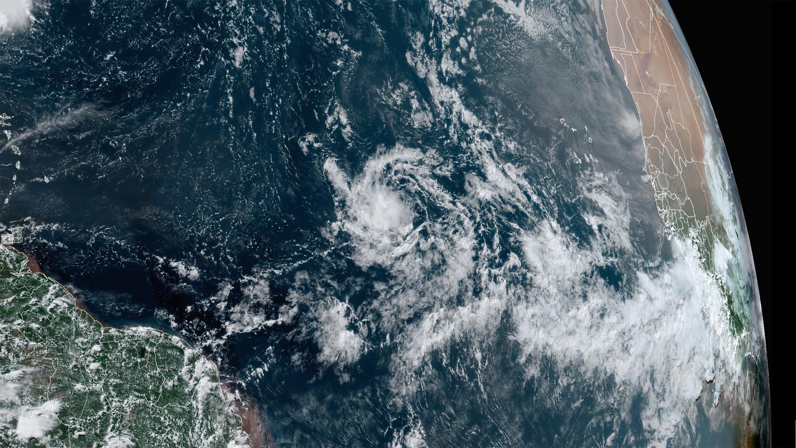
A tropical wave that emerged from the coast of Africa on Wednesday was located midway between the Lesser Antilles Islands and the coast of Africa on Friday afternoon. This system, designated Invest 95L by the National Hurricane Center, could develop into a tropical depression before moving through the Lesser Antilles Islands and into the eastern Caribbean by Tuesday or Wednesday, though plenty of uncertainty remains.
Satellite images showed that 95L had developed a good amount of spin, but heavy thunderstorm activity was being suppressed by a large area of dry air to the north associated with the Saharan Air Layer. Apart from the dry air, conditions were favorable for development, with light wind shear of 5-10 knots and warm sea surface temperatures of 28 degrees Celsius (84°F).


Forecast for 95L
95L was moving slowly west at less than 10 mph because of interaction with the semi-permanent band of heavy thunderstorms to its south called the Intertropical Convergence Zone, or ITCZ. By Saturday, 95L is expected to gain more separation from the ITCZ and begin moving westward at 10-15 mph. This motion should take the system through the Lesser Antilles Islands and into the eastern Caribbean on Tuesday or Wednesday.
Intensification of 95L will depend upon whether the system can build a core of heavy thunderstorms that can resist the dry air to the north. Since 95L is a small system, this process could occur relatively quickly. However, a small system is also prone to sudden disruption from modest increases in wind shear. The 12Z Friday wind shear forecast from the SHIPS model is for shear to remain light, less than 10 knots, for the next six days, but the GFS and European model and their ensembles have not given a lot of support to development of 95L. The 0Z Friday run of the European model ensemble had 10 of its 51 members developing 95L into a tropical depression (and four of those predicting an eventual hurricane). The 12Z Friday run of the GFS model ensemble had eight of its 31 members developing 95L into a tropical depression or tropical storm but none of them predicting a hurricane.
In its 2 p.m. EDT Friday Tropical Weather Outlook, the National Hurricane Center gave 95L two-day and seven-day odds of development of 40% and 60%, respectively. This was a substantial 20% boost from the odds given six hours prior. The next name on the Atlantic list of storms is Emily. The first hurricane hunter mission into 95L is scheduled for Monday afternoon.
Tropical Storm Don continues to wander across the central Atlantic
A week after its formation on July 14, Tropical Storm Don is still plodding across the remote central Atlantic without posing a threat to any land areas. At 11 a.m. EDT Friday, Don had top sustained winds of 50 mph and was headed west-northwest at 10 mph. Don is close to completing a nearly 360-degree clockwise loop over the open ocean and is expected to weaken rapidly on Sunday after moving north of the relatively warm waters of the Gulf Stream. Don is forecast to become a post-tropical cyclone on Monday over the cold Atlantic waters east of Newfoundland, Canada, and will not be a threat to any land areas.

Doksuri may threaten Taiwan as a strong typhoon
Tropical Depression Doksuri was gaining strength on Friday in the Northwest Pacific and is poised to head northwest as a strong typhoon, perhaps swinging over or near Taiwan. Doksuri’s top sustained winds were 35 mph as of 11 a.m. EDT Friday, according to the Joint Typhoon Warning Center. The center predicts Doksuri will intensify steadily through the weekend, hitting typhoon strength by Sunday as it drifts westward, and then reach category 3 strength by midweek, when it should be accelerating to the northwest and making its closest approach to Taiwan. The Philippines weather agency PAGASA (which is calling the storm Egay) was predicting on Friday that Doksuri would reach super typhoon strength (150 mph sustained winds) as it approaches Taiwan. The GFS and European models were much less bullish than the operational agencies, but that may be simply because the system is not yet well enough organized for these global models to depict it well.
As with many systems in the Northwest Pacific, Doksuri is enveloped in a large field of tropical moisture, with showers and thunderstorms (convection) already widespread but disorganized. Wind shear should be relatively modest around Doksuri over the next several days, and the storm will be passing over very warm water, with sea surface temperatures in the neighborhood of 29-30 degrees Celsius (84-86°F), close to average for this time of year. Deeper oceanic heat content beneath Doksuri’s track will be quite high into early next week. Given these factors, it would not be a surprise to see the storm embark on a period of rapid intensification once it gets more organized, potentially on Sunday or Monday.
Upper-level flow is predicted to remain fairly weak around Doksuri well into next week, so the storm may move quite far northward before it recurves east. That means we’ll need to watch for potential impacts later next week toward eastern China, Korea, and Japan.
Website visitors can comment on “Eye on the Storm” posts (see comments policy below). Sign up to receive notices of new postings here.
Source link


