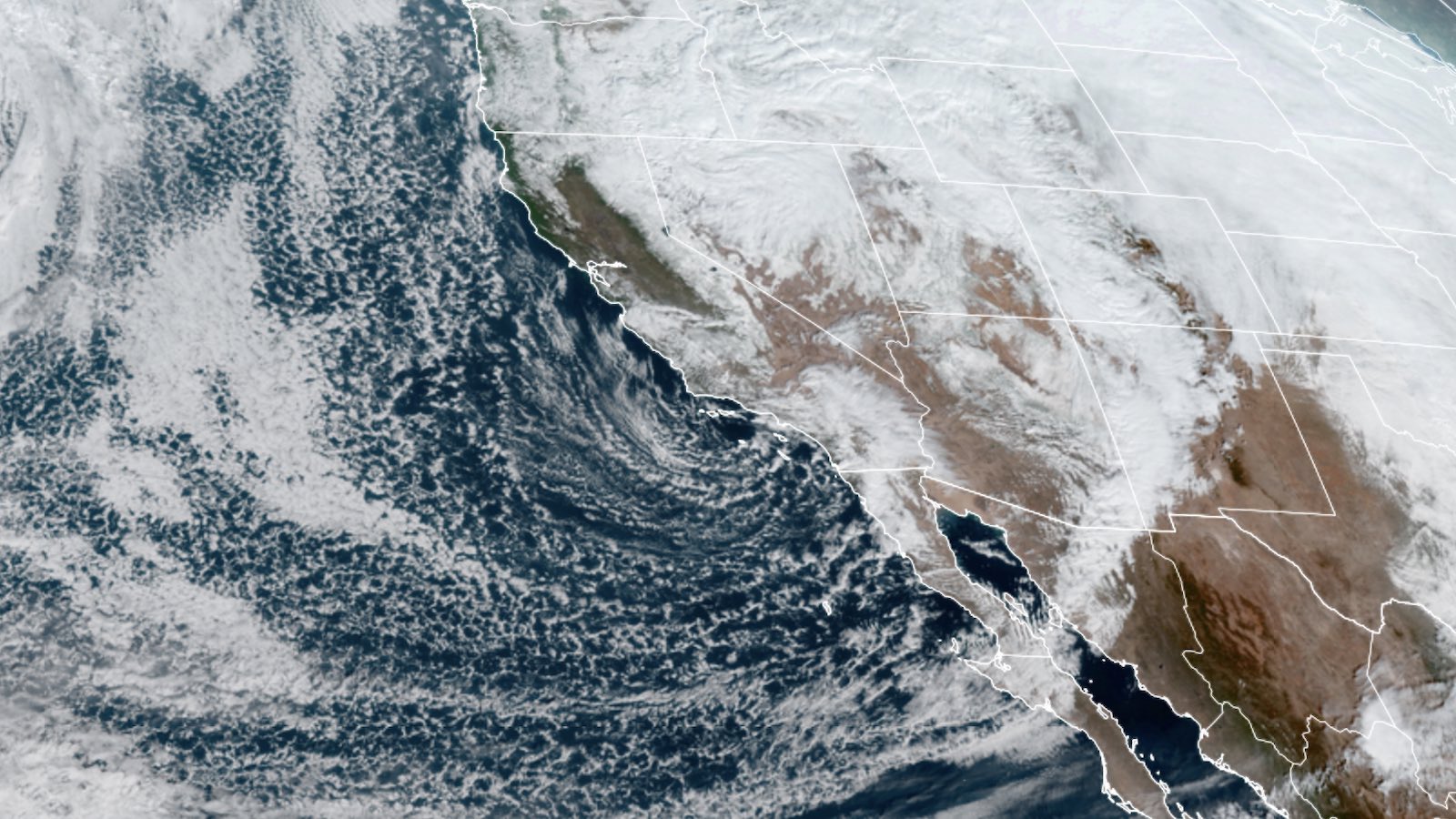
Decembers have been trending warmer across the contiguous U.S. in recent decades, but you wouldn’t guess it from the chilly conditions set to envelop most of the country between now and the new year. A major upper-level storm moving into the West on Monday will set off the big shift. Reinforcements of cold air from Canada and the Arctic will push toward the U.S. over the following few days.
Readings will tumble below average this week from the Rockies eastward, and then dip to even colder levels next week. Much of the central U.S. might stay below freezing for days on end, and temperatures could drop below zero Fahrenheit from Denver to Chicago northward.
Severe storms to prowl from Southern Plains to Southeast
Before the big chill arrives, severe weather will threaten areas from Kansas to Florida. For Monday, the NOAA/NWS Storm Prediction Center placed a strip from northwest Texas to western Kansas under a slight risk of severe weather (level 2 on SPC’s five-tier scale). Severe storms rarely extend so far west in December.
SPC warned that all hazards are possible in the initial supercell thunderstorms—including tornadoes and large hail—before the severe weather morphs into a strong squall line and pushes east during the overnight hours.
A more serious threat will be on Tuesday, as warned by SPC a full week in advance. (That’s unprecedented lead time for a December severe weather outbreak.) As the advancing cold front hits a pool of warmer and moister air from east Texas to Mississippi, severe storms will again erupt. The highest risk (enhanced, or level 3 of 5) is centered on far east Texas and northern Louisiana, where a strong tornado or two will be possible.
Potentially tornadic storms could remain a concern from southern Mississippi and Alabama and southeast Louisiana to the Florida Panhandle through Tuesday night and Wednesday, as the front proceeds eastward while the most unstable air is shunted south toward the central Gulf Coast.
Blizzard conditions sweep across Northern Plains
In stark contrast to the severe weather, the approaching upper-level storm is kicking off intense snow bands over the central and northern Great Plains. Blizzard warnings were in effect from Colorado to North Dakota on Monday afternoon, within a broader zone of winter storm warnings.
It’s a pattern that especially favors the Black Hills of western North Dakota, which could get a foot or more of snow (with much bigger drifts).
Later this week, heavy snow will push across parts of the Great Lakes states. Toward the weekend, the upper-level storm will finally approach the Northeast, triggering development of a nor’-easter-type coastal low.
It’s too soon to nail down specific impacts from the nor’easter, including whether the I-95 cities will get mostly rain or some snow, but snow and ice could extend as far south as the mountains of Virginia, and there’ll be a good chance of heavy snowfall somewhere across the interiors of Pennsylvania and New York.
A snowy Sunday for the British Isles
Winter has arrived in fitting fashion in Great Britain. The London area received several inches of snow on Sunday night, prompting a blizzard of photogenic images in social media. Chilly weather will continue across the area over the next several days.
Website visitors can comment on “Eye on the Storm” posts (see comments policy below). Sign up to receive notices of new postings here.
Source link


