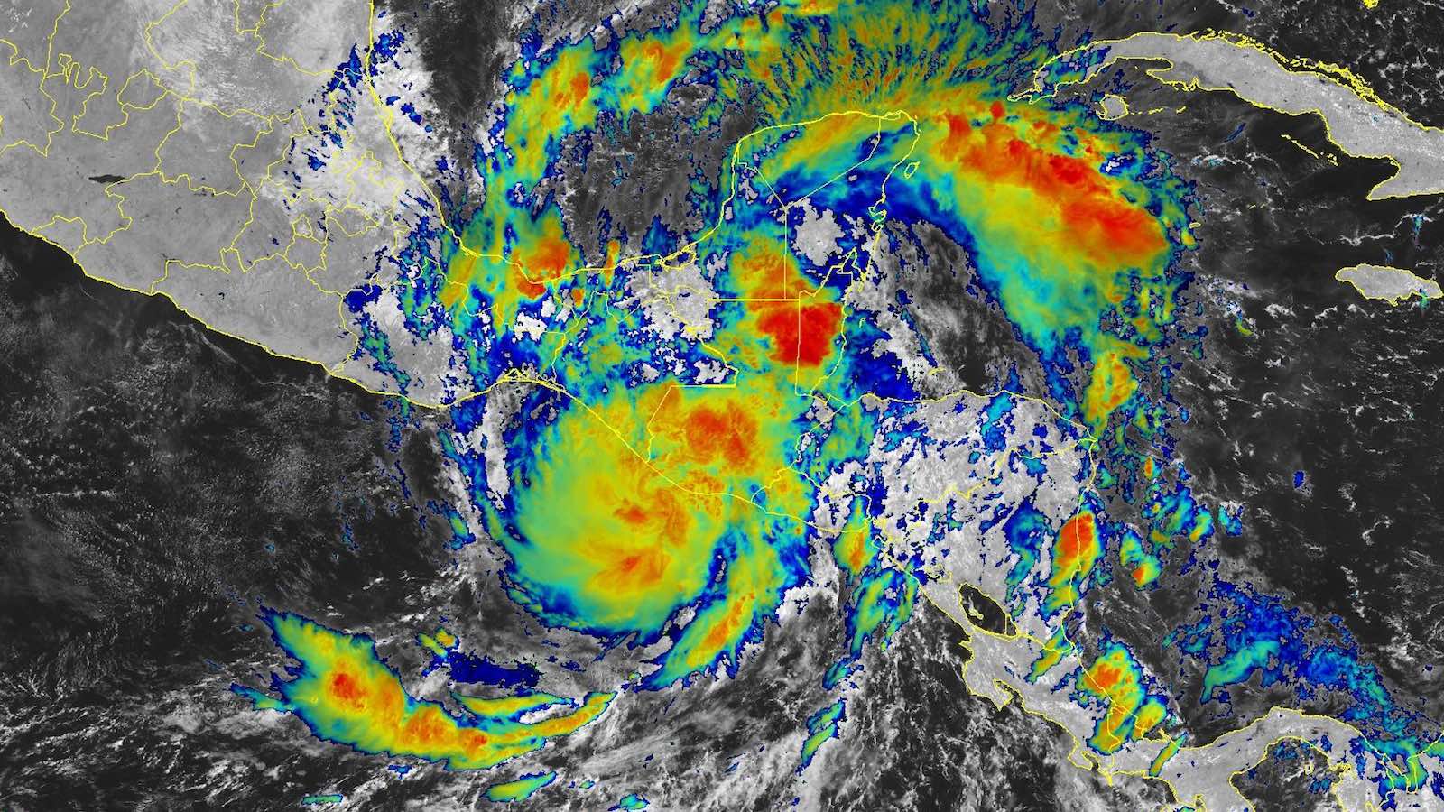
Torrential rains from Julia were scattered across a broad swath of Central America on Monday, as the former hurricane entered what’s expected to be its last day as a tropical cyclone. Localized flooding will continue as a threat, as rich moisture flows across mountainous terrain in the wake of Julia.
Reuters and the news agency EFE reported at least six deaths associated with Julia across Central America and Mexico. In Honduras, well north of Julia’s track, the news agency EFE cited three confirmed deaths in Honduras, with one woman missing, and reports of seven people missing from a capsized boat.
Widespread flooding hit the Nicaraguan capital of Managua on Sunday, when Julia passed only about 20 miles north of town. Managua’s international airport reported 104.7 millimeters (4.12 inches) of rain on Sunday. Even heavier rains struck just to the south. As noted by Jonathan Erdman (weather.com), a total of 406 millimeters (15.98 inches) fell in Liberia, Costa Rica.
Long after Julia brought heavy rain to northern Venezuela on Thursday and Friday, a subsequent burst of rain on Saturday night led to severe flash flooding and a major landslide in Las Tejerías (pop, 54,000), about 40 miles southwest of Caracas. At least 25 deaths have been confirmed, according to Reuters, and another 52 are missing.
Forecast for Julia
Julia became an unusual Atlantic-Pacific crossover on Sunday – a storm that maintained its status as a tropical cyclone while crossing Central America from east to west. Such systems have occurred roughly every five to 10 years during the satellite era, but there were two crossovers each in 1988 (Debby and Joan) and in 1996 (Cesar and Dolly). This year is the first year on record to feature two systems that were at least tropical storm strength in both Atlantic and Pacific: Bonnie and Julia. Since 2000, such systems have retained their Atlantic name after moving into the Pacific.
The National Hurricane Center (NHC) downgraded Julia to a tropical depression with 35-mph sustained winds at 11 a.m. EDT Monday, October 10. Julia was moving west-northwest just inland from the Pacific coast of Central America, centered about 20 miles southeast of Guatemala City, Guatemala, and about 60 miles northwest of San Salvador, El Salvador. With much of its core circulation now inland, Julia was expected to weaken to a post-tropical remnant low by Monday night.
It’s possible that Julia’s remnants will come to life in the Atlantic and/or the Pacific, as the broad spin around Julia is being split by Central America into two areas. One will continue generally westward and could serve as the nucleus of a new tropical cyclone later this week as it moves parallel to the southern coast of Mexico. In its Tropical Weather Outlook at 2 p.m. EDT Monday, NHC gave 30% odds of at least a tropical depression forming in the next five days, mainly between Wednesday and Saturday. (Such a system would get a new name, assuming that Julia is no longer an identifiable circulation.) Few of the European and GFS ensemble model runs from early Monday depict any such development.
Whether or not a new tropical cyclone develops, heavy rains from Julia’s remnants and a broader area of low pressure will continue to spawn the potential for flooding and landslides across parts of Central America and far southern Mexico.
Meanwhile, the north end of this broad envelope of circulation and moisture will likely emerge over the southern Bay of Campeche in a couple of days. Steering currents are expected to keep this area close to the Mexican coast, and wind shear will be increasing, both of which would limit any development. However, the ensemble models above support the idea of a weak circulation in the far southwest Bay of Campeche by later this week. A reconnaissance flight has been tentatively scheduled for Tuesday in the southern Bay of Campeche.
In its 2 p.m. Tropical Weather Outlook on Monday, NHC gave 20% odds of at least a tropical depression forming in the 2- and 5-day periods.
Jeff Masters contributed to this post. Website visitors can comment on “Eye on the Storm” posts (see comments policy below). Sign up to receive notices of new postings here.
Source link


