Potential Tropical Cyclone 2 (PTC 2) finally reached its potential on Friday morning, developing into Tropical Storm Bonnie, the second named storm of the 2022 Atlantic hurricane season. Over the period 1991-2020, the average appearance of the season’s second named storm was July 17, so we are over two weeks ahead of average.
PTC 2 spent a record-long period of time as a potential tropical cyclone: The National Hurricane Center issued 15 six-hourly advisories on the system, beating the previous record of 10 advisories set by PTC 1 (which eventually became Tropical Storm Alex) earlier this year. The difficulty Bonnie had developing speaks volumes about the strong climatological resistance to early-season tropical cyclones forming in the Caribbean, as explained in a Friday Substack post by Michael Lowry (see Tweet below). Hostile upper-level winds creating high wind shear, a dry and dust-laden atmosphere, marginally warm ocean temperatures, and a large-scale region of sinking air in the eastern Caribbean all make it difficult for early-season tropical storms to form.
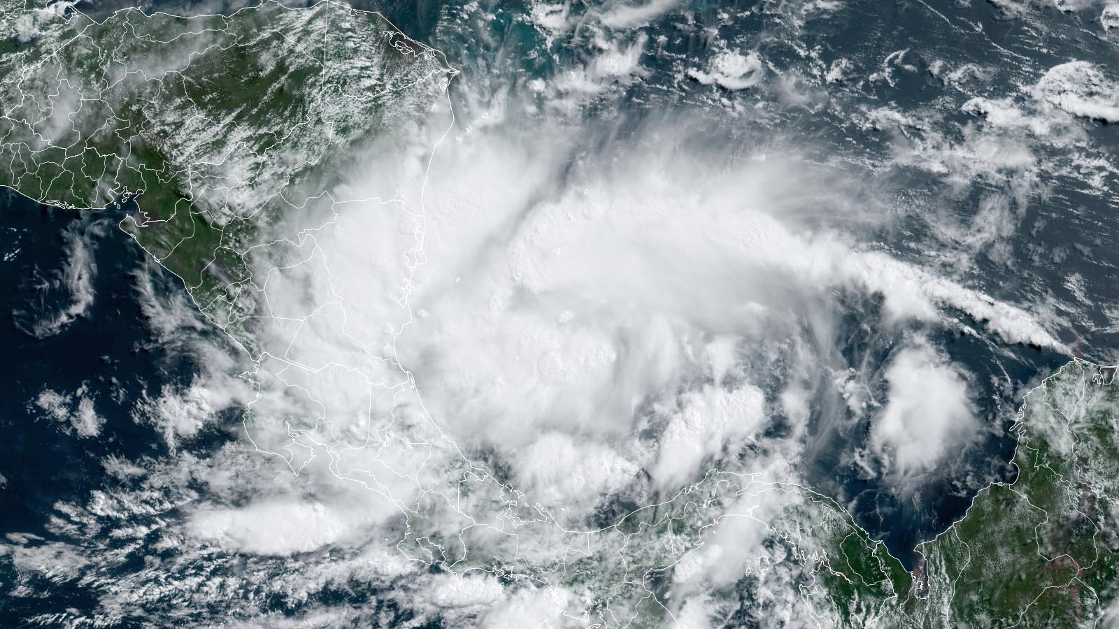
As of 11 a.m. EDT Friday, Bonnie was located 195 miles east-southeast of Bluefields, Nicaragua, speeding west at 20 mph with top winds of 40 mph and a central pressure of 1005 mb. On Friday morning, Bonnie brought heavy rain showers and winds gusting up to 43 mph to Colombia’s San Andres Island, located a few hundred miles east of the coast of Nicaragua.
Satellite images Friday afternoon showed Bonnie was slowly growing more organized, with an increase in low-level spiral bands and heavy thunderstorms. The atmospheric and oceanic conditions around Bonnie will favor strengthening through landfall on Friday night near the Costa Rica/Nicaragua border: light wind shear (below 10 knots), warm ocean temperatures of 28 degrees Celsius (82°F), and a moist midlevel atmosphere (relative humidity 70%). Bonnie is likely to make landfall as a medium-strength tropical storm with 50 mph winds. Heavy rains will be the main threat from Bonnie, with 4-8 inches expected along its path.
Bonnie is expected to survive crossing Central America and become a tropical storm or hurricane in the eastern Pacific by early next week. When such a system remains an identifiable tropical cyclone while crossing Central America, it retains its original name, a policy in place since 2000. If Bonnie degenerates into a tropical disturbance during the crossing and then regenerates in the eastern Pacific, it would have the new name Darby.
Tropical wave entering the Lesser Antilles poses little threat
A tropical wave entering the Lesser Antilles Islands on Friday afternoon was moving west-northwest at 10-15 mph. Satellite images showed that this wave was quite disorganized, and it is headed into an area of high wind shear that will make development unlikely. In an 8 a.m. EDT Friday tropical weather outlook, NHC gave the wave 2-day and 5-day odds of development of 10%.
A quiet period appears to be in store for the Atlantic for at least a week after Bonnie exits stage left, with none of the reliable forecast models for predicting tropical cyclone genesis calling for new activity. If all remains quiet, no new post will occur here until after the July 4 holiday weekend.
Bob Henson contributed to this post.
Website visitors can comment on “Eye on the Storm” posts. Comments are generally open for 30 days from date posted. Sign up to receive email announcements of new postings here. Twitter: @DrJeffMasters and @bhensonweather
Source link