|
|
| Mesoscale Discussion 671 | |
| < Previous MD | |

|
|
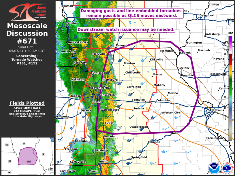
Mesoscale Discussion 0671 NWS Storm Prediction Center Norman OK 1156 PM CDT Mon May 06 2024 Areas affected...Central IA into MO and far western IL/southern IA Concerning...Tornado Watch 191...192... Valid 070456Z - 070630Z The severe weather threat for Tornado Watch 191, 192 continues. SUMMARY...Damaging wind and perhaps a couple line-embedded tornadoes remain possible overnight as an extensive QLCS moves eastward. Downstream watch issuance may eventually be needed. DISCUSSION...An extensive QLCS has recently moved through areas near/south of Kansas City, with multiple mesovortices recently noted along the leading edge of the line. Downstream, the environment remains favorably unstable into central MO, with somewhat cooler and more stable conditions noted into northeast MO, though some recovery remains possible into this area prior to storm arrival. Low-level shear/SRH remains strong according to regional VWPs, and a threat for line-embedded tornadoes and damaging gusts will continue eastward through the early overnight hours. Some threat is likely to eventually move eastward out of WW 192, and downstream watch issuance into parts of central/eastern MO may eventually be needed. ..Dean/Guyer.. 05/07/2024 ...Please see www.spc.noaa.gov for graphic product... ATTN...WFO...ILX...LSX...DVN...SGF...DMX...EAX... LAT...LON 38089464 39739444 40469421 40829290 40799173 40299093 39159064 38279105 38059139 37999319 38019346 37989397 38089464 |
|
|
Top/All Mesoscale Discussions/Forecast Products/Home |
|