|
|
| Mesoscale Discussion 668 | |
| < Previous MD | |

|
|
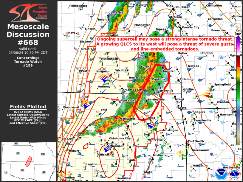
Mesoscale Discussion 0668 NWS Storm Prediction Center Norman OK 0935 PM CDT Mon May 06 2024 Areas affected...Northeast OK into southeast KS Concerning...Tornado Watch 189... Valid 070235Z - 070330Z The severe weather threat for Tornado Watch 189 continues. SUMMARY...A discrete supercell will pose a strong/intense tornado threat, while a growing QLCS to the west may pose an increasing threat for severe wind gusts and line-embedded tornadoes with time. DISCUSSION...A discrete supercell has recently intensified across northeast OK, and may be producing a strong to intense tornado, based on rotational velocity, environment, and TDS characteristics. Strong instability and intense low-level shear/SRH (with 0-1 km SRH increasing above 400 m2/s2 on the KINX VWP) will continue to support intense tornado potential with this cell as it moves northeastward. Farther north and west, a growing QLCS will pose an increasing threat of severe wind gusts and line-embedded tornadoes as it moves eastward. This QLCS will eventually tend to absorb the ongoing tornadic cell and other discrete cells that may develop ahead of the line, which would potentially increase the tornado threat in the area of the QLCS where these mergers occur. ..Dean.. 05/07/2024 ...Please see www.spc.noaa.gov for graphic product... ATTN...WFO...TSA...ICT... LAT...LON 36179632 36509655 37959566 37919528 37669510 37359514 37169531 36599560 36229588 36149614 36179632 |
|
|
Top/All Mesoscale Discussions/Forecast Products/Home |
|


