|
|
| Mesoscale Discussion 645 | |
| < Previous MD | |

|
|
   Mesoscale Discussion 0645
   NWS Storm Prediction Center Norman OK
   1019 PM CDT Sun May 05 2024

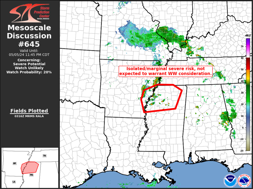
   Areas affected...parts of the eastern Arkansas/northern Mississippi
   vicinity

   Concerning...Severe potential...Watch unlikely

   Valid 060319Z - 060445Z

   Probability of Watch Issuance...20 percent

   SUMMARY...A couple of stronger storms may become capable of marginal
   hail, strong wind gusts, and/or a brief tornado.  Limited/isolated
   nature of the threat is expected to preclude the need for WW
   issuance.

   DISCUSSION...Latest radar loop shows an increase in convective
   coverage across the Mississippi Delta region, with one storm having
   acquired a noted rotational signature via KLZK WSR-88D
   storm-relative velocity data.  The storms are occurring in a zone of
   QG ascent -- near a well-defined low moving across northwestern
   Arkansas per WV imagery, near the nose of a 40 kt
   south-southwesterly low-level jet.  While deep-layer flow remains
   generally modest, the enhanced low-level shear being provided by the
   nocturnal increase in the low-level jet suggests appears to be
   aiding in storm organization/rotation.

   With the storms on the northern fringe of a more unstable airmass to
   the south, ample buoyancy combined with the aforementioned favorable
   ascent should support a continuation of storms, with some increase
   in coverage possible as convection shifts eastward into northern
   Mississippi and southwestern Tennessee.  However, with severe risk
   expected to remain limited, WW issuance appears likely to remain
   unnecessary.

   ..Goss/Guyer.. 05/06/2024

   ...Please see www.spc.noaa.gov for graphic product...

   ATTN...WFO...MEG...JAN...LZK...

   LAT...LON   34139145 34709125 35049026 35028910 34688847 33588896
               33369121 34139145
|
|
|
Top/All Mesoscale Discussions/Forecast Products/Home |
|


